October 17, 2025
Monitoring Snow Water Resources in the Burned Forests of Oregon’s Cascades
Posted by Sage Ebel
Introduction
Wildfire activity has been increasing across the western United States, impacting snow accumulation and melt patterns with major consequences for water storage and flood risk. To study these changes, in the summer of 2022 we began building a network of snow monitoring stations in a burned forest of Oregon’s western Cascades.
Over the next two winters, we installed ten stations across gradients of elevation, slope, and burn severity. With two full years of data now in hand, we’re beginning to see how this wildfire alters snow storage and melt in ways that affect downstream communities. These data are now being used to improve forecasting models that account for wildfire disturbances.
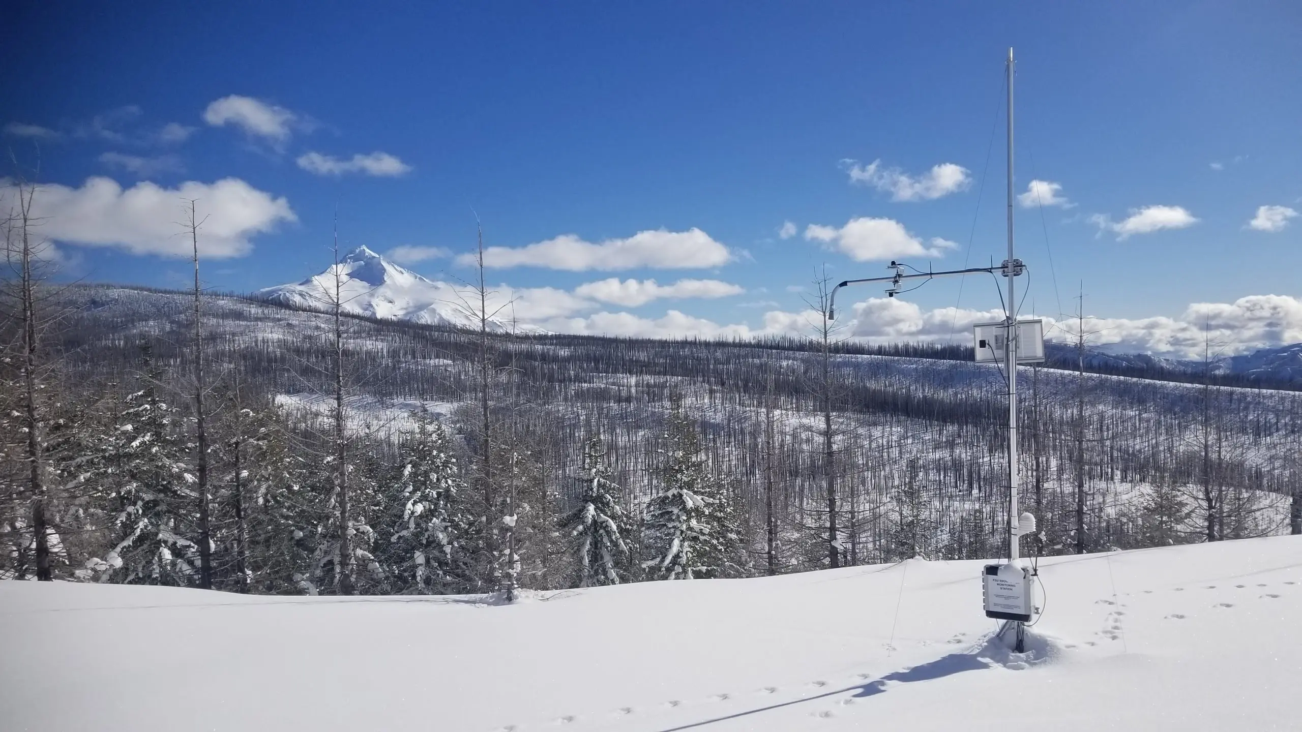
Mount Jefferson is the backdrop for the monitoring stations. This Cryologger station is located in an open area in the highest elevation band of the study drainage.
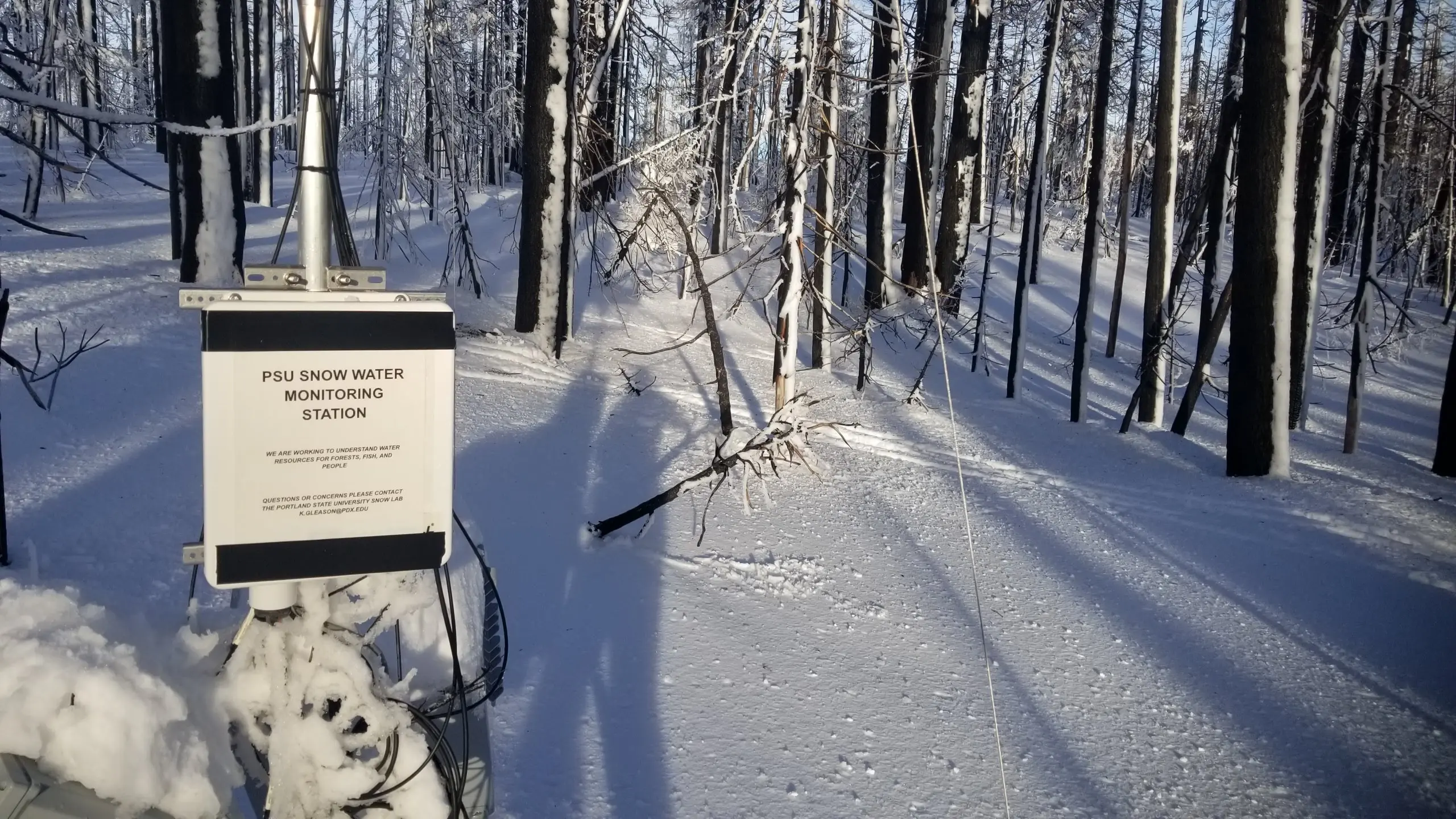
The Sites
Our stations are located in the Roaring Creek drainage, a tributary of the Breitenbush River that flows into Detroit Lake Reservoir. This reservoir supplies drinking water to more than 180,000 residents of Salem, Oregon.
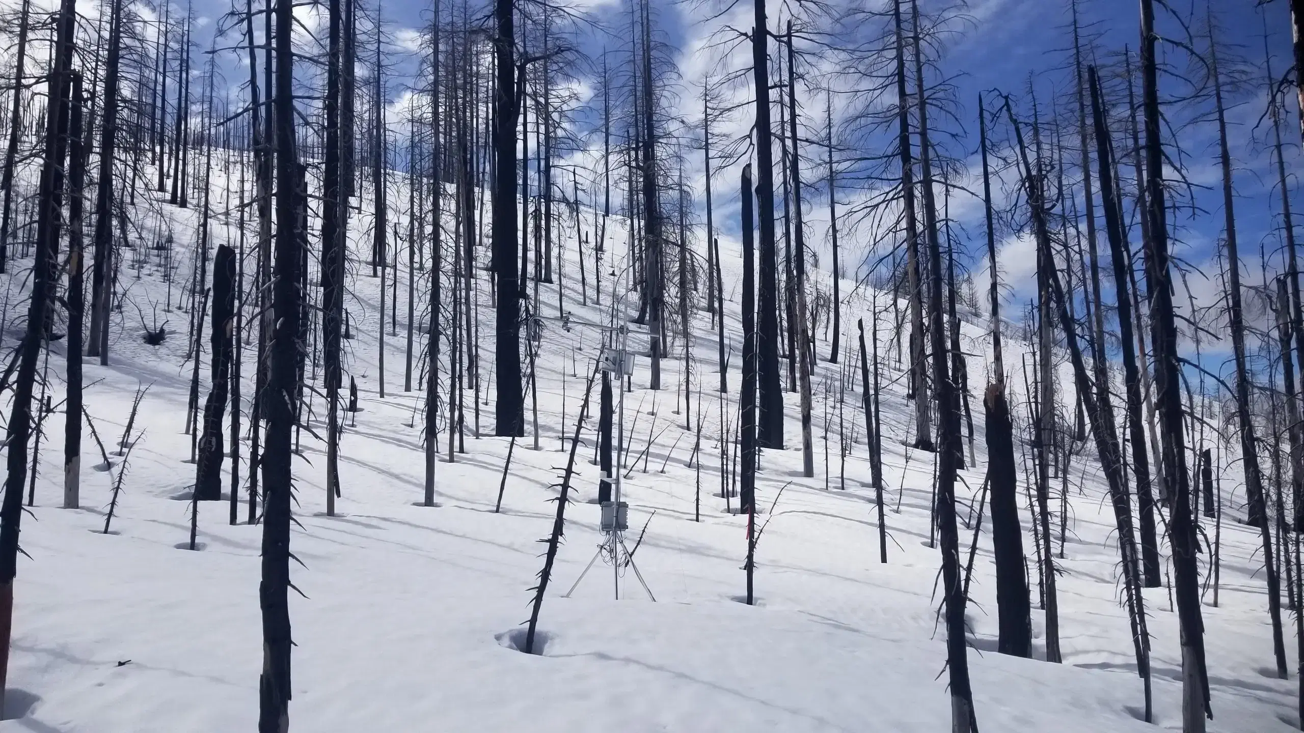
The 2020 Lionshead Fire burned nearly 80% of the Breitenbush watershed and 100% of the Roaring Creek drainage. The drainage is characterized in the lower elevations by large old-growth forests and ephemeral snowpacks that accumulate and melt regularly throughout the season, and at higher elevations by persistent, deep snowpacks and smaller vegetation.
With its opposing north- and south-facing slopes and a patchwork of burn severity, the drainage provides an ideal natural laboratory for studying how fire influences snowpack dynamics from the rain–snow interface to the alpine.
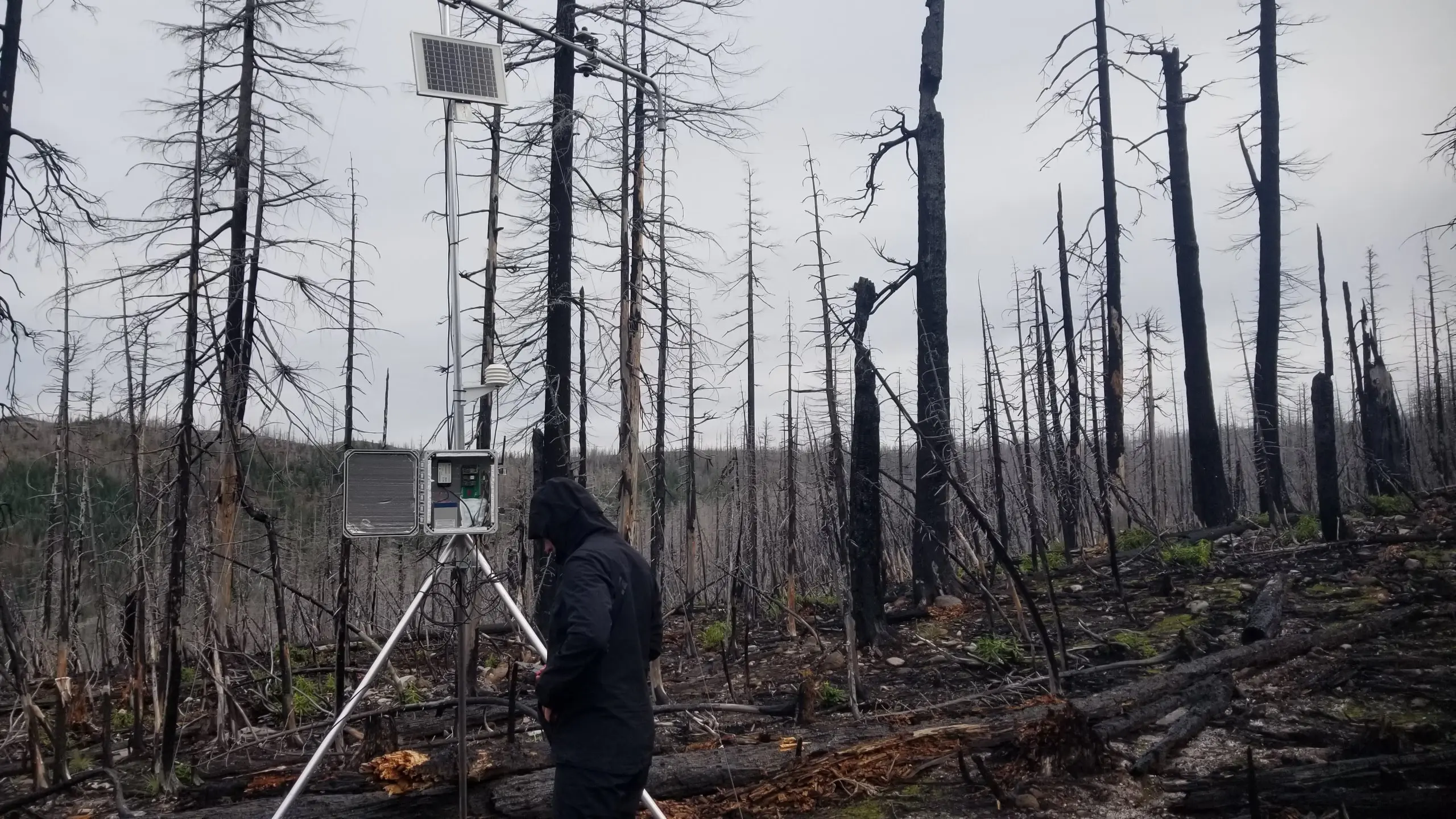
Devon Vigil assesses how well one of the Cryologger stations is collecting data during installation in the fall of 2023.
Deployments
We first deployed three primary stations at high-severity burn sites across the elevation gradient. We later expanded our network with seven additional Cryologger systems installed in unburned forests and open sites, as well as on both north- and south-facing slopes.
Each station measures temperature, humidity, snow depth, solar radiation, and soil moisture—enough to drive a simple snowpack energy balance model. The stations run continuously, powered by small solar panels and batteries, providing invaluable control and reference data for our investigations.
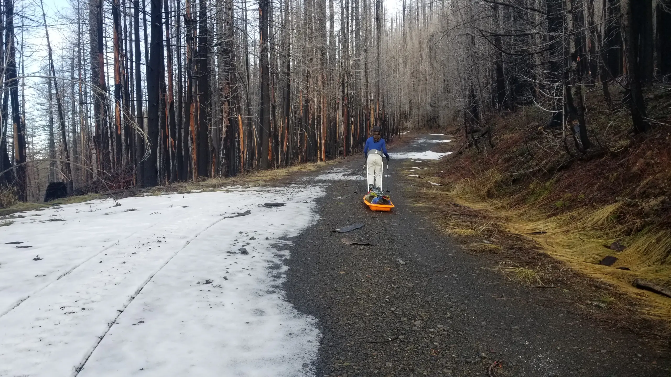
Downed trees, deep intermittent snow, and melted-out portions of the road made for difficult installation conditions in the fall of 2022. Here, Nani Ciafone drags some heavy equipment up the seven-mile forest road to the sites.
Research
Our lab is now analysing the growing dataset. Current research projects include:
- Sage Ebel – Investigating how wildfire and rain-on-snow events combine to drive midwinter flooding and reduce potential spring snowpack, a critical water source in summer.
- Devon Vigil – Building a representative SnowModel for a burned forest in the Oregon Cascades to simulate the impacts of wildfire on snow processes. Albedo decay equations for SnowModel are derived from the station data.
- Logan Hastings – Using the in situ data collected from these stations to inform and improve operational watershed-scale modelling post-fire in HEC-HMS.
Why Cryologger
Expanding our network to capture diverse forest conditions required a flexible, affordable platform. Cryologger allowed us to customise sensors for our specific needs, build more stations within budget, and gain valuable technical skills in the process.
The dense forests of the Pacific Northwest are an incredibly challenging place to monitor snow. With long ski-in approaches and heavy snowfall, visiting ten sites regularly presented a major logistical challenge. An advantage of the Cryologger system is its low power demand. Even under nearly fully covered canopy, each station runs on a 10-watt solar panel and a single 9-volt battery. The reliability of these systems has been essential for maintaining long-term monitoring in difficult conditions.
What’s Next
Integrating the work developed by Dr. Christopher Cosgrove, we plan to complete the development and deployment of a communication system for the station network. This upgrade will utilise short-range (~1 km) radio signals to relay data from the Cryologger stations to a single base station for real-time transmission via the standard Cryologger satellite communication methods.
This system will reduce satellite costs while providing near real-time snowpack data for our lab.
The study data supports research by Portland State University and informs water operations by the United States Army Corps of Engineers, who are responsible for managing the downstream water reservoirs.
It Takes a Team
We could not have done this work without the help of Adam Garbo, who tirelessly answered all of our questions as we built these stations, Chris Cosgrove for his ideas and support, and the long list of field helpers including Devlin Rutherford, Ben Jelinsky, Kelsey Hefner, Megan Guinn, Kelsey Regan, Nathaniel Brodie, and many others.
Thank you all!